Kenton to St Albans - 14/02/20
 |
| Route: Kenton to Carpenders park (link) |
Early Start (a bit pants :-) )
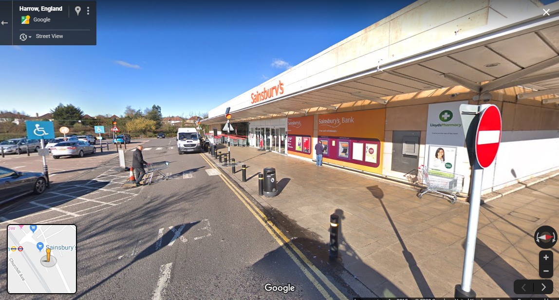
I left my sister's house around 8am and headed towards Sainsburys in Kenton. I had to get a refund on a 3 pack of pants bought the previous day. There had only been 2 pairs when there should have been 3. It took the Indian lady in the customer service an age to do the refund. All this computerisation is supposed to be so modern but sometimes it seems to me it is a lot worse. Another indian lady came over to help. She had an unusual Indian name that I could not remember. It's probably just the Indian equivalent of something like Janet but who knows.
I had a chat with another cyclist by the cycle rack outside the supermarket. He warned me about the weather forecast for the afternoon. He told me the rain was on it's way and would hit with a vengeance around 2pm. I said I was heading for Watford and thought I would be back by 2 so I was not bothered.
Decided to take a new route to Wealdstone that I have been thinking about for months. Headed over the railway bridge at Kenton Station and then along Elmwood Avenue, Francis Road. It follows the course of West Coast Main line up to Harrow and Wealdstone. It is a nice back route towards Harrow and Wealdstone and one that I have rarely taken. I usually go through Kenton Park.
Followed Elmgrove Road to Station Road (A409). I would be following this road north for the next 2.5 miles.
A typical London suburban shopping parade followed (they all look the same). My next target which was something called 'The Weald Stone'. I had been researching this on the Internet. I had been looking up the origin of some of the local area names; e.g. Kingsbury, Queensbury. It turns out that Wealdstone is named after an ancient standing stone (see: here).
(Incidentally, Kingsbury is an original Saxon name whereas Queensbury was chosen by way of a newspaper competition when the underground railway station was built. Not a lot of people know that.)
The Weald Stone (link)
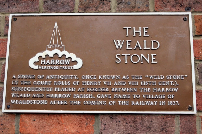
I knew the stone was located outside a pub but I could not remember the name. I had travelled a fair way up Wealdstone High Street, past my brother and sisters' old grammar schools; Salvatorian College and Sacred Heart. I did not see any pubs, least not with a stone outside. I knew what to look for because I had seen a picture when doing the research.
I concluded I had already passed the location but then noticed a road sweeper who looked like he knew the area. "Excuse me mate. Do you know where the Weald Stone is? I think it is outside a pub around here somewhere". He replied with a rasping, probably tobacco induced, voice. "Yeah, it's over there" he said laughing. "Only it's not a pub any more. Now it is Bombay Central!" (an Indian restaurant).
This made me laugh. "Sign of the times, eh," I said. "All hail our multi-cultural overlords!"
I found the Weald Stone and took a few pictures. There was a line of Rickshaws outside the restaurant and a bottle of mineral water on top of the stone. I proceeded to move it so I could take a picture but then the bottle's owner apologised and removed it for me.
There was a nice sign on the wall of the pub/restaurant with the history of the Weald Stone or "Weld Stone". Read it for yourself. The doors of the restaurant looked like they were constructed to withstand a nuclear blast or the loading bay of Red Dwarf. I guess there must have been a few break ins.
On to the cemetery
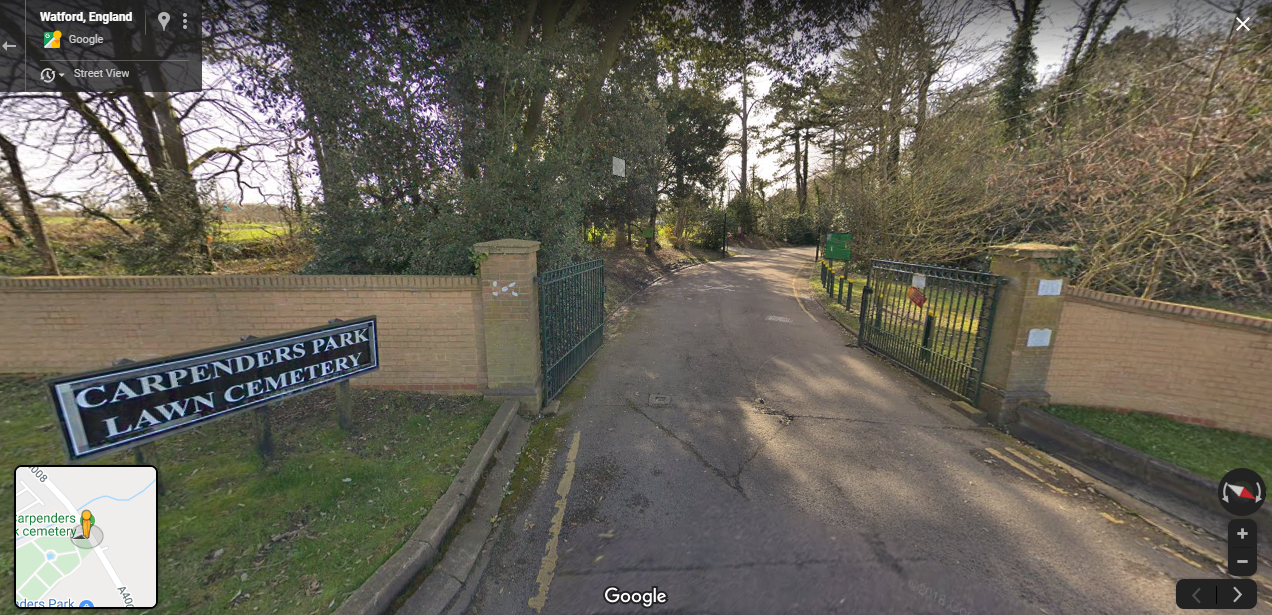 |
| Carpenders Park cemetery entrance |
Carried on North, past the Uxbridge Road to the next turn, Old Redding. Curiously, it has the same name as the town where I live (but a different spelling). I followed this to the end where it meets Oxhey Lane then approximately 1/2 mile to the entrance to Carpenders Park cemetery on the left.
I went to visit my Mum's grave. It took a while to find it. Carpenders Park is a 'garden' cemetery and the gravestones are of the 'plaque in the ground' variety. I searched for 20 minutes and saw plenty of Irish and Polish names (not at all surprising in the Roman Catholic section of the cemetery) but no sign of my Mum's.
I eventually found the plaque after a good deal of searching. The turf had overflowed the edges and a had to remove tufts of it and push it back so it was even round the edges. I filled a plastic watering can and removed the excess mud with water and paper towels and wiped it clean. I said a Rosary for my Mum and stood at the grave contemplating the transitory nature of life. The rain stopped for a few minutes and the sun came out. It was very solemn and peaceful.
 |
| Route: Bushey to North West Watford (link) |
Wandering in Watford
| Watford High Street |
I continued up the Oxhey Lane (A4008) towards Watford. I made progress much more rapidly than I had expected.
At the Royal Oak (Watford Heath) there was a sign indicating Town centre avoiding restriction which was essentially the main car route into Watford. I decided to take the quiet route via Watford Heath which led to me getting a bit lost. It was more fun thought I as got to explore local Watford. Sometimes getting a bit lost and going off the beaten track is good fun.
I wasn't really consulting the map at this point for some reason so I got a bit lost in west Watford. Eventually saw a railway bridge on the right and guessed that I needed to be on the other side of this in order to travel in the general direction of St. Albans. It turns out that this was the Bushey to Watford High Street branch line. It was the right decision.
It led through some terraced residential housing past an old Church. I followed an alley along the side of the church then asked a lady with a pushchair the way to central Watford as I was a little lost. I followed the road round a large green. This eventually led to Watford High Street.
I then followed the pedestrianised high street, starting with a large pyramid, all the way along until I reached a flyover. I made a big mistake at this point. I should have definitely looked at the map here.
Watford to St Albans - taking the wrong road
At the end of Watford High Street there was a flyover which seemed to be heading in the general direction of St. Albans. A walkway led under to flyover and connected with a road heading out of town. A sign indicated that the road led to St. Albans so I followed this road. This proved to be a mistake.
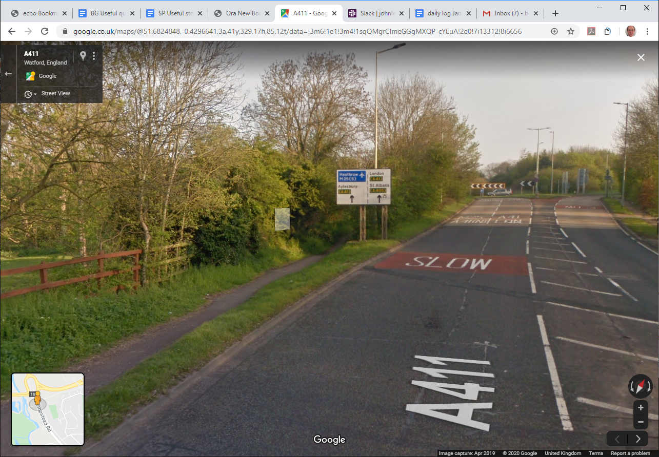
The road I had taken was the Hempstead Road which headed North West from Watford. I saw a sign for Cassiobury on the left - I remember visiting this park as a child. The road eventually intersected with the A41. There was a footpath/underpass avoiding the main road which I took. However, when the path emerged on the other side of the roundabout I realised my mistake. The signs no longer mentioned St. Albans. They now mentioned Kings Langley and Leavesden.
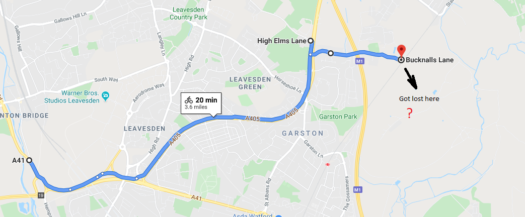
I decided to head back to the roundabout and now followed the busy A41. This was a dual carriageway but fortunately there was a footpath on the left. The path got a bit confusing around Leavesden but I eventually worked my way onto the A405. I Noticed a sign for St. Albans and Garston so I knew I was back on the right track.
After about 15 mins riding I came to a road on the left, High Elms Lane next to St Michael Catholic School. The cycle path terminated at this point and as the dual carriageway was heading for an intersection with the M1/M25 I did not want to be cycling anywhere near the fast traffic. So I consulted the map and found a detour.
I headed back along the North Orbital St. Albans Road to the junction with Bucknalls Lane. This road led in the direction of Bricket Wood and allowed me to cross the M1. I went passed the entrance to BRE and followed a path into Bricket Wood. It did not link up with the rest of Bricket Wood as the road in BRE were private.
 |
| Route: A41 to Bricket Wood (link) |
Lost in Bricket Wood
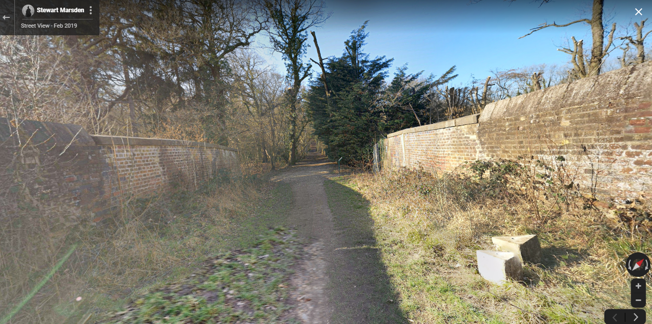 |
| (crossing the Watford->St. Albans Abbey railway line in Bricket Wood) |
The path (continuation of Bucknalls Lane) became increasingly muddy and eventually became unrideable. I found a bridge which crossed the Watford->St Albans Abbey line but once across this bridge the path was not very well signposted. I appeared to be going around in circles in the middle of Bricket Wood. I spotted a large field through the trees so I walked in a straight line towards it. I supposed that where there was a field there was probably a road.
 |
| Route: (Back on Track) School Lane to St. Albans (link) |
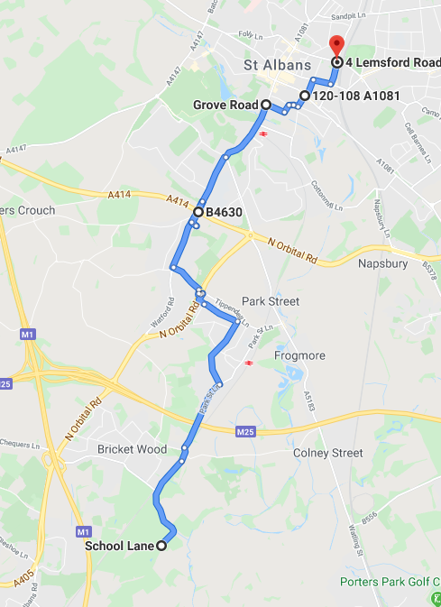
I found the road; which was School Lane; and took the left (NE) direction on instinct. This was the correct decision as it eventually led to Bricket Wood station. From here there were signs to St. Albans. I started following the Abbey Way (cycle route) which indicated St. Albans, 4 miles.
The Abbey Way led me through How Wood but the end result was that I got a bit lost again. I do not know why I did not look at the map at this point as I would have definitely headed towards Park Street and then to Watling Street (A5183). I know the way from here as my brother used to live near there in Cottonmill.
Instead, I eventually found myself at the intersection of North Orbital Road and Tippendell Lane. I crossed a huge footbridge over the dual-carriageway and asked a lady the way to St. Albans. She told me to follow Tippendell Lane to Simmons Bakers and then turn-right 'and just keep going'. Once I reached Simmons Bakers I recognised where I was - in Chiswell Green. I have been that route by car hundreds of times.
 The rest of the route was fairly uneventful. Followed the Watford Road to the King Harry pub then St Stephens Hill, St Peter's Hill.
 I took a slight detour to avoid the steep hill (Belmont Hill, Thorpe Road, Sopwell Lane, Old London Road, Watsons Walk).
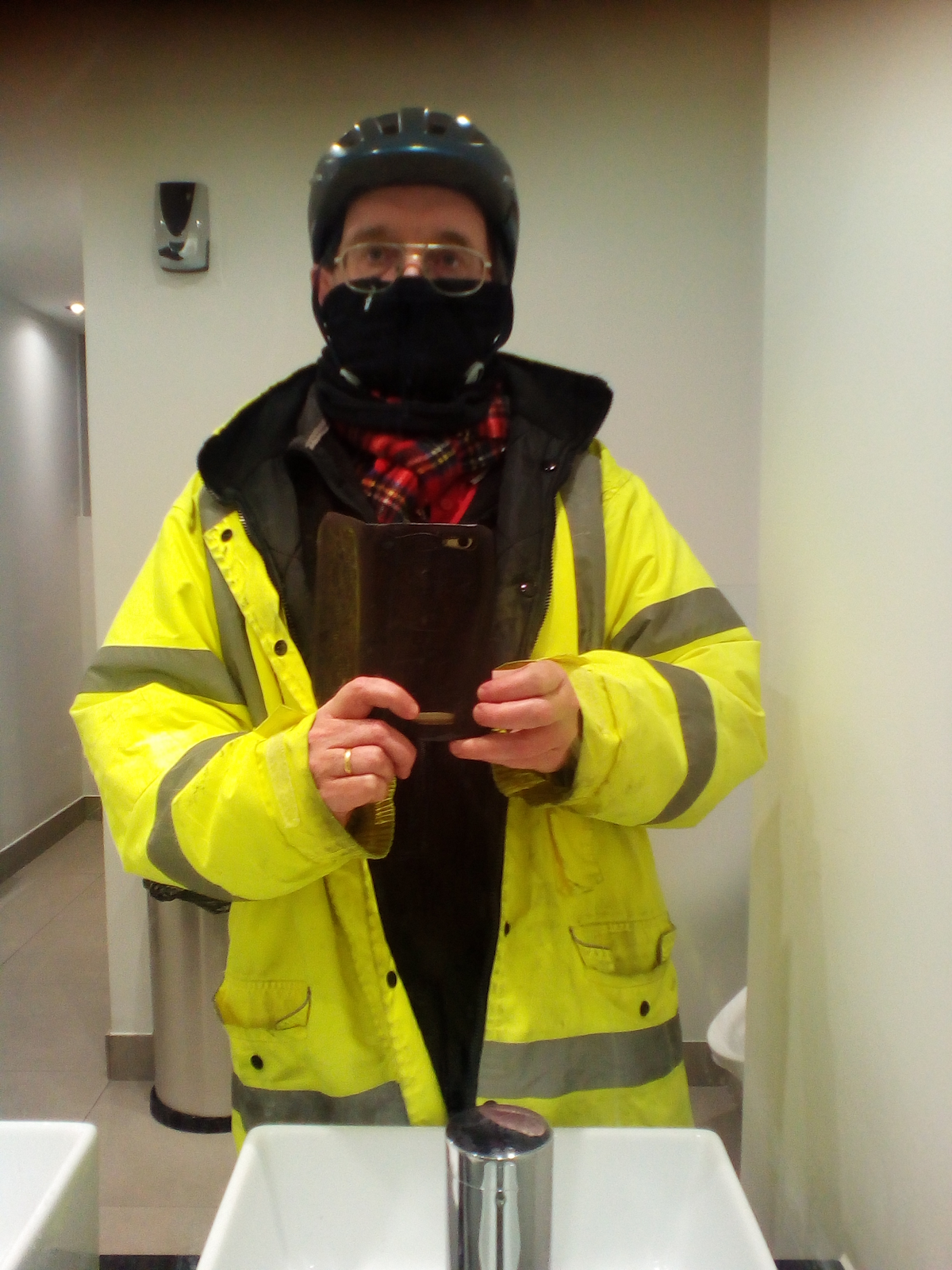
Then on to visit my sister's house. My brother in law thought I was a council workman. Well I did look the part.
Interesting. Brings back memories of 30 years ago when I used to wonder through bricket wood on my 2 hour lunch hours. 😁
ReplyDelete