Monday, 9 March 2020

Reading to Hook (Epilogue - Epiblog?) - 07/03/20

I repeated the Reading to Hook route with my son. Here are some additional observations.

Alternative route at Stratfield Saye House

I tried taking an alternate route at Stratfield Saye House. There is a road with a picket fence. Just after it crosses the river Loddon. It seems to give alternate options in joining the A33 further down. Unfortunately, it is more of a track than a properly surfaced path.

About 1/2 way along you need to cross the river Loddon again to continue on the path and then it is more of the same gravelly/muddy path. I would not recommend this route again and if it is cold or very wet then forget it.

(attach picture)

Punctures
I got 2 punctures on this trip. They were both caused by the same stone. We took a wrong turn at Stratfield-Saye and ended up at the Iron Duke pub. On the detour back I noticed my front wheel getting very soft and stopped.

I had a spare innertube, but decided to try and patch the tyre; the reason because I could not find the cause and suspected I would get another; which is what happened.

The 2nd puncture was not immediate (surprisingly). We stopped for water and my son, Joseph, could visibly see air leaking out of the tyre. I removed the innertube, for a second time, and found another hole. It was in a symmetrical position in relation to the valve; so I had obviously flipped the tube last time, and hit the same stone. Joseph then found the stone in the tyre and removed it.

We had stopped to fix the puncture on a traffic island with a nice bench, next to a bus shelter, in Hartley Wespall. A kind lady stopped her car to check if we were ok. She said her husband had a garage full of tools and could help if we needed. We did not need the help but it was a nice gesture.


Hook loopback route to Rotherwick


Stopped at a Café in Hook for a 2nd breakfast.

Then over the railway past the big Tesco towards the M3 motorway junction. It's a bit trickly crossing the M3 slip road as the traffic tends to speed up off the roundabout to join the M3 to London. The other side is better because there are some traffic lights.

Then along the A287 for about 100m and take a right onto Hook road. Here again, we went on the pavement until the junction and then crossed the busy dual carriagway very carefully. Once onto Hook road it is much quieter.

Where the streets have no name
Through the sleepy village of Greywell and onto 'The Street'; I have noticed there are lots of roads called 'The Street' with this name in many of the villages.  The word street has its origins in the Latin strata; meaning "paved road" - abbreviation from via strata (see: https://en.wikipedia.org/wiki/Street)

My theory is that in many of these villages this street was the first to be paved where the others were all just dirt roads. Effectively, the village equivalent of High Street in any town.

Stopped at the junction with Upton Grey Rd for a break - this is the onward route heading for Chawton (where Jane Austen lived) which I will cover in a later blog post.

Then followed the curving road to Up Nately. Turn right at the red telephone box into the woods, heading back to the M3. This time there is a bridge and you just fly over in no time. Just under 1/2 mile more and you have to cross the London Road (A30). It was not very busy on this occasion but I would take care when it is!

Straight across, then onto Crown Lane heading for Newnham/Rotherwick. This is a very pretty road leading under a railway bridge.


Wednesday, 4 March 2020

Reading to Hook (and back again) - 01/03/20


Reading to Hook (and back again) 01/03/20 (route)


Headed for Burghfield Road from Southcote and then over Burghfield Bridge.

I made a mistake just after the Cunning Man. I should have taken the left fork at the Bridge Cafe as I have done many times before but I thought maybe it was the next turn (it was not!). Consequently, I ended up having to take the road over the M4 motorway, which I hate, because there is always a nasty headwind and then a maelstrom of noise as you cross the M4.

The logical next alternative was the upcoming left turn called 'The Mearings'. This is marked as a private road but I have never had any problem being stopped and it is always very quiet.

It runs past AWE Burghfield. It looks like the kind of place I can imagine being detained in isolation when one catches the Corona Virus.

At the end of this road took a left turn onto James Lane past Burghfield sports club.


I got a bit confused at this point and had to consult the map. I have an offline app, Maps.me, on my phone. It is not as good as google maps/streetview but it means I can turn off the wireless on my phone; which extends the battery life. Whenever I am a bit lost, I consult the map. Generally, I try to avoid this as it slows me down but it is a very useful resource. The most annoying thing about it is that the map is split into regions of the country which can be downloaded when the phone is connected (by wireless). There have been several occasions when I was cycling in a region (e.g. East of England) which was not on the phone and I did not have a map.

I had approx 3 hours before it got dark, and I had forgotten to bring bike lights; it turns out I did - see later; so if I did not reach my destination by 4.30 I would have to turn around. I did not want to be stuck on dark country lanes, or worse, an A or B road in the dark.

Along Goring Lane (heading east) and then right onto Goodboy's Ln. This a nice road through the woods. On a warm day (20°C and above) in the late spring this is a glorious bit of riding - I wonder if there a bluebells in those woods. The daffodils are out and the weather was Sunny but it was a bit cold (about 7°C). It had been forecast rain all day so I had a lucky break.

Goodboy's Ln ends at some kind of plush golf club (De Vere Wokefield Estate Golf Club). I stopped there once and had lunch. I went just inside the gates and sat down on the grass. I remembered because that was the day when I left my water bottle on the wall of the entrance and only realised after 2 miles further down the road; and had to go back for it.

Turned east onto Cross Lane and then a right fork just after crossing over the Reading to Basingstoke railway line - I was a bit too far west due to my earlier mistake of not taking left turn at Bridge Cafe. This led me to a cross-roads where I took a right turn onto Grazeley Road heading for Beech Hill. This ends at old church (name?). There is a quiet graveyard which is another good place to stop and have a break.

A useful tip I picked up somewhere is that graveyards are a good place to fill up your water bottle. They tend to have public taps (for people to water the flowers left by the graves). I will have to check this one next time I am there.

Turn right onto Beech Hill Road and then left just after The Elm Tree pub onto Trowes Lane. This is another of my favourite roads. It starts with a step hill, and you can practically coast all the way to the River Loddon crossing. If you pedal hard you get to Stratfield Saye in minutes. You need to make sure to take the right fork otherwise you head for the A33 much to early.


For the next 10 minutes you need to essentially follow the perimeter of Stratfield Saye House; you will see big gates on your left and some with yellow entrance lodges either side. Make sure to turn left when you see a sign for "The Iron Duke" pub. Over a bridge across the river Loddon (again) towards the A33. After this, there is long picket fence on the left which seems unending, but eventually you reach the the Wellington Arms, which is another good place to stop; There are picnic benches there.

Immediately across the A33 (slightly to the left) is a small road with a sign to Mattingley (and Daneshill school) - take care crossing the busy road. This road meanders through more woods and comes to an end about 500m past the school. I took a left towards Mattingley - in retrospect, I should have gone right to Hartley Wespall but more about that later.

I followed Bottle Lane due east. I missed a turning to the right, which I ignored because it looked like a farm track, and consequently after about 10 minutes I ended up at the Leather Bottle pub on the B3349. This was too far North; I had been intending to meet this road further south to avoid the fast traffic.

The next section down the B3349 was just grin-and-bear-it riding. Most cars are really responsible and give you plenty of room. Occasionally I would pull over to let a queue, which had built up, clear. About every 5 minutes you get somebody giving you a close pass, which is a bit scary. This usually happens because there is traffic coming the other way and the driver does not want to wait so they just squeeze between you and the approaching vehicle, forcing you into the gutter. You can moan about it all you want but it does not change the reality of the situation.

Here lies the body of Henry Gray
He died defending his right of way.
He was right, dead right, as he rode along,
But he’s just as dead as if he'd been wrong.


As you approach Hook there is a steep downhill section which is great fun racing down. I am not sure it will be so much fun on the way back though.

I made it to Hook without any further mishaps and visited a friend. I had a nice cup of tea, some biscuits and a 15 minute chat, but then had to set off pretty sharpish. The reason; it would be dark soon.

The Return Leg (route)

Earlier, on the B3349 approaching Hook; when looking for safer, quieter routes for the way back; I had spotted a turn-off for Rotherwick, just before the downhill section approaching Hook. I targetted this exist to avoid the heavy traffic on the B3349. I had to negotiate the steep hill first though. I stopped halfway to let a queue of cars pass which had built up behind me and got a few appreciative waves. The turnoff is not far from the crest of the hill. Death averted for the present.  :-)

The next mile was a very pleasant; a quiet run through the woods which ended at a crossroads in Rotherwick. I stopped for a banana, which had turned a deep shade of brown at the bottom of my backpack. I consulted the offline map and saw that the road heading north (Wedman's Lane) changed to a bridleway further up; but basically headed in the right direction. I though I would chance it. This decision was influenced by the fact I discovered I did have my lights after all; so I would not to completely stranded if it got dark.

The bridleway turned into a muddy quagmire very quickly. I should have anticipated this considering all the puddles I have been through, some about 6 inches deep! I returned to the crossroads, and headed west through the village.

I've cycled through Rotherwick village before. It is very pretty. There is an old classic red telephone box which has been converted to a mini-library. I'll have to take a look next time I go there.

Passed through the village past the church then left onto Frog Lane followed by Rotherwick Lane to Hartley Wespall.  I almost messed up again here were there is a fork. You need to take the right fork along Turgis Green Lane.

I followed this to the end where a sign indicates Stratfield Saye to the left; Mattingley to the right.  I took the left option.  It leads to a BP Garage on the A33. I decided to cycle along a short section of the A33 to the Wellington Pub.  There is actually a section of pavement for about 400 metres to the Jeckyl and Hyde pub but then it is back on the road.  The traffic was ok though. The road surface is also much smoother than the B3349 (see earlier).  Retrospectively, I noticed there is an alternative left turn about 400m before the Wellington Pub. I'll have to investigate this next time.

It's a funny thing; cycling make you much more aware of rivers, and river valleys generally. When planning a route, which I like to make as direct as possible, I constantly run into problems where the smaller roads just end, due to the presence of a river. For example; this route seems to constantly run up against the River Loddon and you have to detour and plan route around it. The nicest thing is when you find a small road that providentially has a bridge and allows a more direct route.

From the Wellington pub was really just a retrace of my earlier route. The most memorable thing here was that it started to (a) rain and (b) get dark. The sun was setting and I could see dark rain clouds in the west and heavy rain falling over Reading in the distance.

Passed through Stratfield Saye, Beech Hill and Grazeley then onto one of my favourite well-known routes; Pump Lane and Kybes Lane.  In Kybes Lane it really started to get dark and it was difficult to avoid the puddles and the potholes. I only hit one which made a nasty bang, but no damage.

Back over the M4; past Green Park and then crossed the railway and along Berry's Lane.  This time I found the shortcut, indicated by 2 big concrete bollards; leading the the Bridge Cafe and the Cunning Man pub.

I found the etymology of the name Cunning Man quite interesting. It seems to derive from a local legend of a Wizard in Tadley.

The final section between the River Kennet and the Holy Brook was a bit scary. Although I had lights the batteries were a bit low. I was worried a car would not see me as a crossed the bridge, which narrows at the apex. Fortunately, there was no traffic.


Thursday, 23 January 2020

Kenton to Reading - 15/01/20

Kenton to Reading - 15/01/20


Left Kenton about 10.30am. The weather was a bit drizzly but not cold. Headed along Northwick Park Road towards the Hospital. At the Watford Road roundable took the underpass to avoid death on the busy roundabout. Then along Kenton Road/Lowlands Road to Harrow. Past Greenhill College where my brother Marc did his A-levels. It seems like yesterday but was about 30 years ago.

I stopped outside a BP garage next to the big double roundabout near Harrow on the Hill station. I still had not decided my route but consulting the map (Maps.me offline map) I found a residential backway. This linked HotH to North Harrow via West Harrow (Vaughan Rd, Bouverie Rd, The Gardens, Blenheim Rd). It is always good fun discovering new routes. The back roads are always very quiet and much less stressful.

At North Harrow, I followed Imperial Drive as far as Rayners Lane Baptist Church, then a right turn into Village Way. Here there are another series of residential roads heading in almost straight line due west (Village Way, Eastern Ave, North View, Elm Avenue, Pembroke Rd and Kingsend).

At this point I took a slight detour to go and see the house where my uncle Bob lived for about 50 years. Its a very nice house.

(picture)

The next big was weaving through some residential streets aiming for the Breakspear Arms. First cross the River Pinn (Sharps Lane, Southcote Rise, Westcote Rise then footbridge to Grasmere Ave.  Then more zig-zagging: Grasmere Ave, Whiteheath Ave, Ladygate Ln then left into Breakspear Rd. There is probably a better route here but this was just reconnaisance (which I quite enjoy).

The transition between leaving the London suburbs and entering the green belt is quite dramatic. You got from well ordered leafy tree lined streets to what seems like endless brambly bushes covered in a thin veneer of black grime.

If this green-belt is the lungs of London then all I can say is that has a un-diagnosed case of black lung (link).

The next part of the route is a bit of a pig; in terms of crossing the colne valley. There are not many options. The A40 is effectively a motorway at this point and there are no paths on the side. On this ride I took a route north of the a40.

The route I took was: Breakspear Rd South, Newyears Green Ln, Harvil Rd, Moorhall Rd (crossing the Colne Valley and Grand Union Canal) and Moorfield Road culminating at Denham Green.
I had to make another decision here. I was trying to cross the M40 but the only realistic choices were NW to Chalfont St. Peters and riding along a section of the A40 to Tatling End. I chose the A40.
This section was not pleasant. Fortunately, there was a path along the side of the dual carriageway otherwise it would have been a non-starter. The traffic was quite heavy on the dual carriageway and it was windy and rainy. Additionally, I was cycling into a headwind uphill. It took 10 minutes to get past the worst section which culminated at the top of a hill.

The next section was more level. I had to navigate a junction of 2 big roads but the footpath was ok. I then went past a Toby Carvery (Tatling End) and a small shopping parade. This was followed by a bridge crossing the M25. Immediately after the bridge was a turning on the right (Fulmer Rd) which ultimately led to the village of Fulmer (Doh!). This was a very nice change for the earlier heavy traffic and noise of the busy dual carriageway.


Tuesday, 21 January 2020

Kenton to St Albans - 14/01/20

Kenton to St Albans - 14/02/20


Route: Kenton to Carpenders park (link)


Early Start (a bit pants :-) )


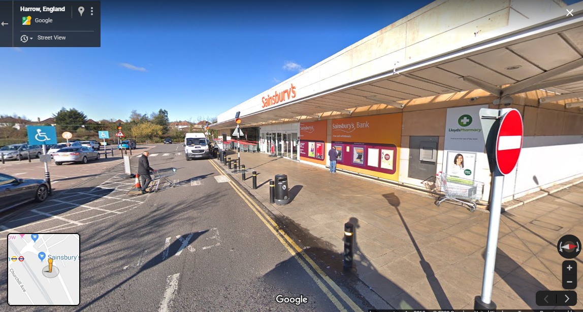
I left my sister's house around 8am and headed towards Sainsburys in Kenton. I had to get a refund on a 3 pack of pants bought the previous day. There had only been 2 pairs when there should have been 3. It took the Indian lady in the customer service an age to do the refund. All this computerisation is supposed to be so modern but sometimes it seems to me it is a lot worse. Another indian lady came over to help. She had an unusual Indian name that I could not remember. It's probably just the Indian equivalent of something like Janet but who knows.

I had a chat with another cyclist by the cycle rack outside the supermarket. He warned me about the weather forecast for the afternoon. He told me the rain was on it's way and would hit with a vengeance around 2pm. I said I was heading for Watford and thought I would be back by 2 so I was not bothered.

Decided to take a new route to Wealdstone that I have been thinking about for months. Headed over the railway bridge at Kenton Station and then along Elmwood Avenue, Francis Road. It follows the course of West Coast Main line up to Harrow and Wealdstone. It is a nice back route towards Harrow and Wealdstone and one that I have rarely taken. I usually go through Kenton Park.

Followed Elmgrove Road to Station Road (A409). I would be following this road north for the next 2.5 miles.

A typical London suburban shopping parade followed (they all look the same). My next target which was something called 'The Weald Stone'. I had been researching this on the Internet. I had been looking up the origin of some of the local area names; e.g. Kingsbury, Queensbury. It turns out that Wealdstone is named after an ancient standing stone (see: here).

(Incidentally, Kingsbury is an original Saxon name whereas Queensbury was chosen by way of a newspaper competition when the underground railway station was built.  Not a lot of people know that.)

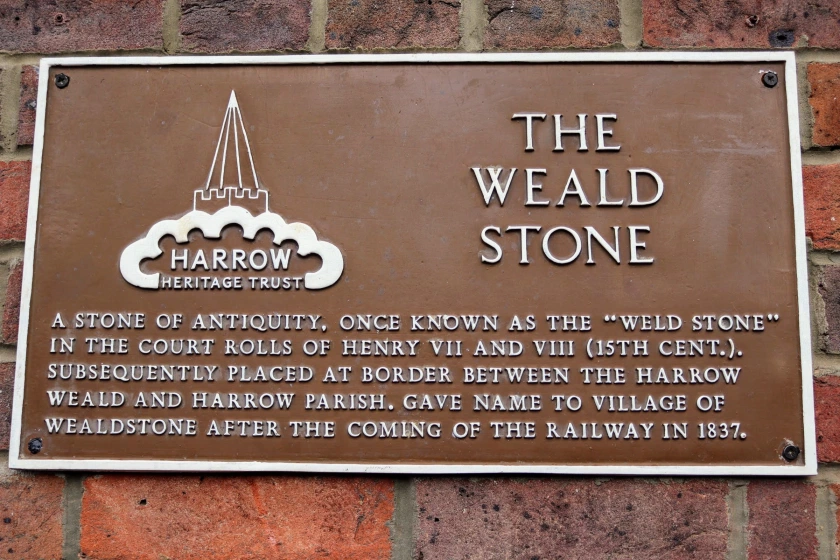
The Weald Stone (link)


I knew the stone was located outside a pub but I could not remember the name. I had travelled a fair way up Wealdstone High Street, past my brother and sisters' old grammar schools; Salvatorian College and Sacred Heart. I did not see any pubs, least not with a stone outside. I knew what to look for because I had seen a picture when doing the research.

I concluded I had already passed the location but then noticed a road sweeper who looked like he knew the area. "Excuse me mate. Do you know where the Weald Stone is? I think it is outside a pub around here somewhere". He replied with a rasping, probably tobacco induced, voice. "Yeah, it's over there" he said laughing. "Only it's not a pub any more. Now it is Bombay Central!" (an Indian restaurant).
This made me laugh. "Sign of the times, eh," I said. "All hail our multi-cultural overlords!"

I found the Weald Stone and took a few pictures. There was a line of Rickshaws outside the restaurant and a bottle of mineral water on top of the stone. I proceeded to move it so I could take a picture but then the bottle's owner apologised and removed it for me.

There was a nice sign on the wall of the pub/restaurant with the history of the Weald Stone or "Weld Stone". Read it for yourself. The doors of the restaurant looked like they were constructed to withstand a nuclear blast or the loading bay of Red Dwarf. I guess there must have been a few break ins.


On to the cemetery

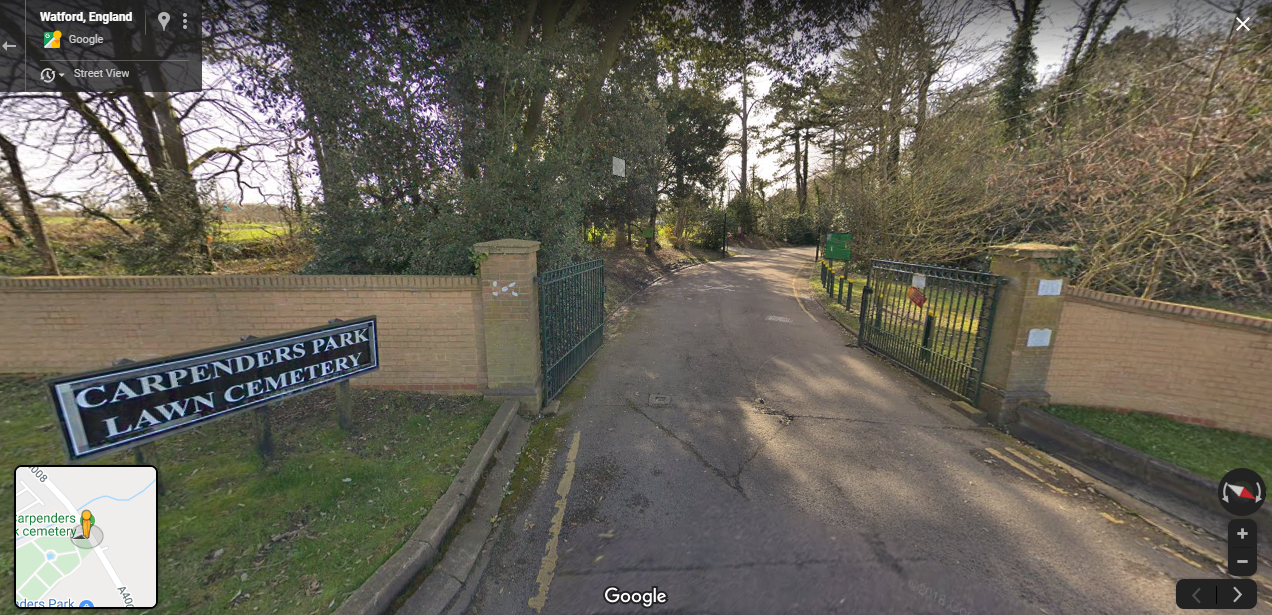
Carpenders Park cemetery entrance

Carried on North, past the Uxbridge Road to the next turn, Old Redding. Curiously, it has the same name as the town where I live (but a different spelling). I followed this to the end where it meets Oxhey Lane then approximately 1/2 mile to the entrance to Carpenders Park cemetery on the left.

I went to visit my Mum's grave. It took a while to find it. Carpenders Park is a 'garden' cemetery and the gravestones are of the 'plaque in the ground' variety. I searched for 20 minutes and saw plenty of Irish and Polish names (not at all surprising in the Roman Catholic section of the cemetery) but no sign of my Mum's.

I eventually found the plaque after a good deal of searching. The turf had overflowed the edges and a had to remove tufts of it and push it back so it was even round the edges. I filled a plastic watering can and removed the excess mud with water and paper towels and wiped it clean. I said a Rosary for my Mum and stood at the grave contemplating the transitory nature of life. The rain stopped for a few minutes and the sun came out. It was very solemn and peaceful.


Route: Bushey to North West Watford (link)

Wandering in Watford

Watford High Street

I continued up the Oxhey Lane (A4008) towards Watford. I made progress much more rapidly than I had expected.

At the Royal Oak (Watford Heath) there was a sign indicating Town centre avoiding restriction which was essentially the main car route into Watford. I decided to take the quiet route via Watford Heath which led to me getting a bit lost. It was more fun thought I as got to explore local Watford. Sometimes getting a bit lost and going off the beaten track is good fun.

I wasn't really consulting the map at this point for some reason so I got a bit lost in west Watford. Eventually saw a railway bridge on the right and guessed that I needed to be on the other side of this in order to travel in the general direction of St. Albans. It turns out that this was the Bushey to Watford High Street branch line. It was the right decision.

It led through some terraced residential housing past an old Church. I followed an alley along the side of the church then asked a lady with a pushchair the way to central Watford as I was a little lost. I followed the road round a large green. This eventually led to Watford High Street.

I then followed the pedestrianised high street, starting with a large pyramid, all the way along until I reached a flyover. I made a big mistake at this point. I should have definitely looked at the map here.


Watford to St Albans - taking the wrong road


At the end of Watford High Street there was a flyover which seemed to be heading in the general direction of St. Albans. A walkway led under to flyover and connected with a road heading out of town. A sign indicated that the road led to St. Albans so I followed this road. This proved to be a mistake.

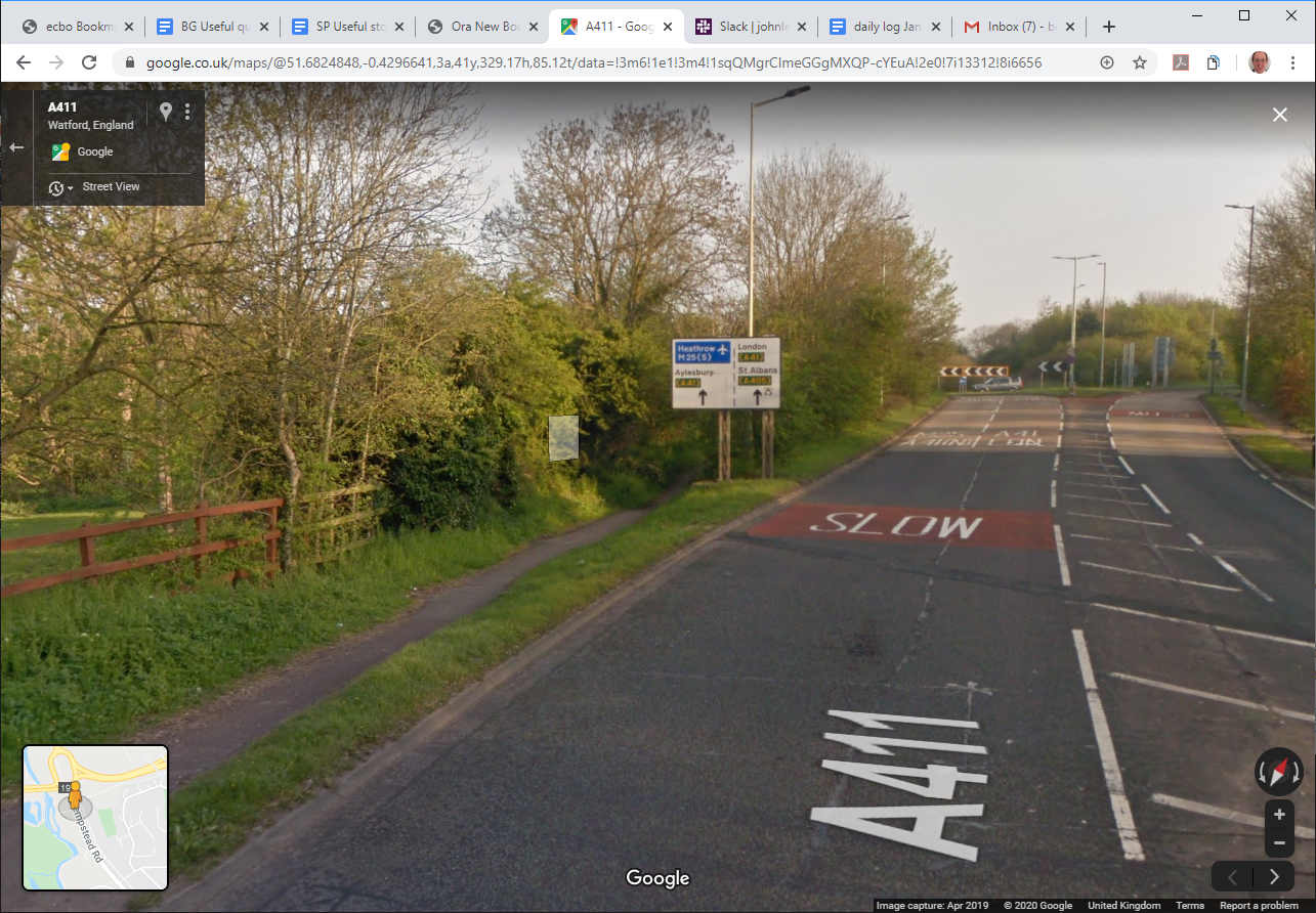
The road I had taken was the Hempstead Road which headed North West from Watford. I saw a sign for Cassiobury on the left - I remember visiting this park as a child. The road eventually intersected with the A41. There was a footpath/underpass avoiding the main road which I took. However, when the path emerged on the other side of the roundabout I realised my mistake. The signs no longer mentioned St. Albans. They now mentioned Kings Langley and Leavesden.

I decided to head back to the roundabout and now followed the busy A41. This was a dual carriageway but fortunately there was a footpath on the left. The path got a bit confusing around Leavesden but I eventually worked my way onto the A405. I Noticed a sign for St. Albans and Garston so I knew I was back on the right track.

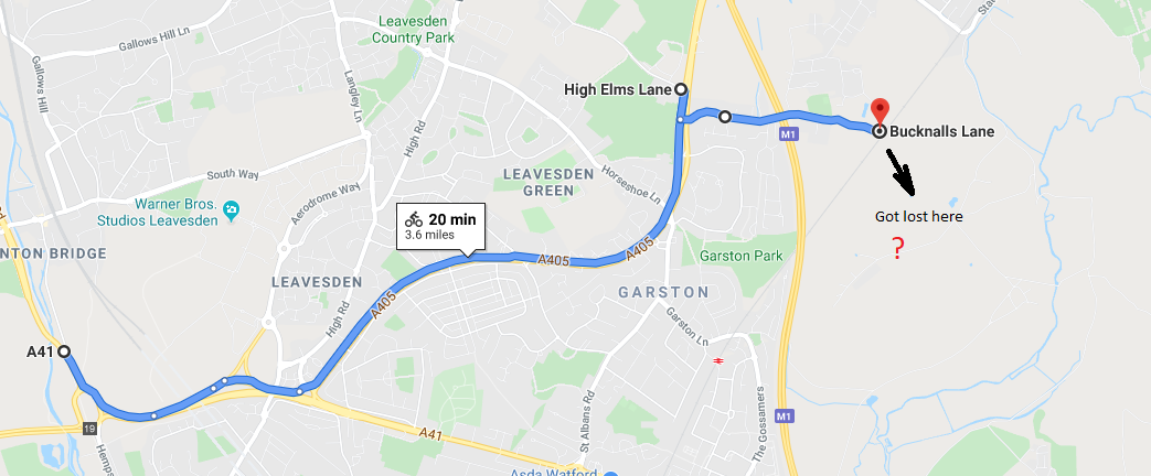
After about 15 mins riding I came to a road on the left, High Elms Lane next to St Michael Catholic School. The cycle path terminated at this point and as the dual carriageway was heading for an intersection with the M1/M25 I did not want to be cycling anywhere near the fast traffic. So I consulted the map and found a detour.

 I headed back along the North Orbital St. Albans Road to the junction with Bucknalls Lane. This road led in the direction of Bricket Wood and allowed me to cross the M1. I went passed the entrance to BRE and followed a path into Bricket Wood. It did not link up with the rest of Bricket Wood as the road in BRE were private.

Route: A41 to Bricket Wood (link)

Lost in Bricket Wood


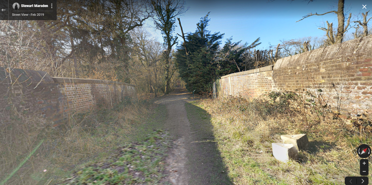
(crossing the Watford->St. Albans Abbey railway line in Bricket Wood)

The path (continuation of Bucknalls Lane) became increasingly muddy and eventually became unrideable. I found a bridge which crossed the Watford->St Albans Abbey line but once across this bridge the path was not very well signposted. I appeared to be going around in circles in the middle of Bricket Wood. I spotted a large field through the trees so I walked in a straight line towards it. I supposed that where there was a field there was probably a road.

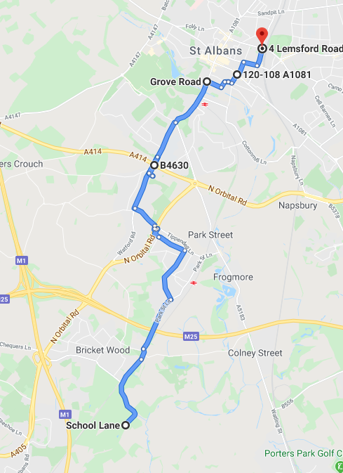
Route: (Back on Track) School Lane to St. Albans (link)
 

I found the road; which was School Lane; and took the left (NE) direction on instinct. This was the correct decision as it eventually led to Bricket Wood station. From here there were signs to St. Albans. I started following the Abbey Way (cycle route) which indicated St. Albans, 4 miles.

The Abbey Way led me through How Wood but the end result was that I got a bit lost again. I do not know why I did not look at the map at this point as I would have definitely headed towards Park Street and then to Watling Street (A5183). I know the way from here as my brother used to live near there in Cottonmill.

Instead, I eventually found myself at the intersection of North Orbital Road and Tippendell Lane. I crossed a huge footbridge over the dual-carriageway and asked a lady the way to St. Albans. She told me to follow Tippendell Lane to Simmons Bakers and then turn-right 'and just keep going'. Once I reached Simmons Bakers I recognised where I was - in Chiswell Green. I have been that route by car hundreds of times.

The rest of the route was fairly uneventful. Followed the Watford Road to the King Harry pub then St Stephens Hill, St Peter's Hill.

I took a slight detour to avoid the steep hill (Belmont Hill, Thorpe Road, Sopwell Lane, Old London Road, Watsons Walk).

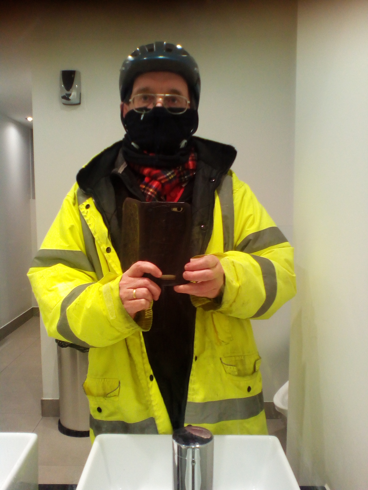
Then on to visit my sister's house. My brother in law thought I was a council workman. Well I did look the part.


Wednesday, 9 October 2019

IoW Tour 2019 Day 2 - Shanklin to Cowes, East Cowes to Reading (15/09/19)

Isle of Wight Tour 2019

 
Day 2  - Shanklin to (West) Cowes, East Cowes to Reading
(15/09/19)


Started with a (full-English) cooked breakfast at 8am.  A short (5min) walk from the hotel to Shanklin station, then 15 minutes train journey to Ryde Esplanade


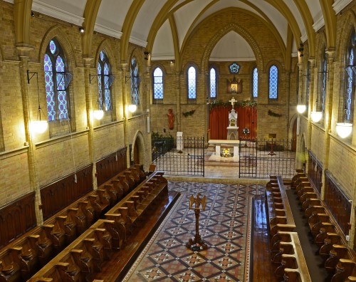
We walked from Ryde Esplanade to St Cecilia's Abbey for Latin Mass at 10am. Beautiful angelic singing from the Nuns (the nuns are behind those gates on the right of the sanctuary.  Here is their perspective).

Walked back past the classic car show and saw an old 1960s Ford Thames similar to the family car from the 1960s.

Got train back to Shanklin and picked up bikes and backpacks from the hotel.


Rode along the cycle path from Shanklin to Wroxall. This starts around the back of Shanklin station near Lidl and gently curves around the edge of the downs towards Wroxall. Saw plenty of horse riders on the route. There are still a few railway bridges from long-ago.


Up on the downs


At Wroxall, we took the road up onto St Martins Down. Ended up getting a bit lost. Headed up a path indicated 0.5 miles to the radar station, past some cows (with very big horns! Highland Cattle possibly?).  I was a bit scared but Joe was not and when he approached they just moved out the way.

I discovered later that we had gone the wrong way and that we were initially on Luccombe Down but the view was great anyway.


Then a very very steep chalky path up onto the top of the downs. By climbing over a stile the view was absolutely spectacular (above) looking down into Sandown Bay.

You could also see the cliffs at Freshwater (right) leading to the Needles on the other side of the island.

Followed a smooth grassy path that led along the top of the downs to the radar station on the top of St Boniface Down.


From here took a very steep road down down down to Ventnor. There was a fantastic 180° vista of the sea as we cycled very carefully down the 1in4 incline.

The rims of my wheels were very hot when we reached the bottom and the brakes had started making metallic squeaking noises (new brakes anyone!).


Headed North back to Wroxall on  B3327. Stopped at a little convenience store for some snacks.

We sat on a nearby bench to eat and a brief rest. Joe had a cider and some gluten-free provisions from his pack.  I had some salami sticks and a pork pie. The salami sticks were good for cycling as they are very dense. I stuck the remaining ones in my pack to munch on later.


Appeldurcombe House

Headed towards Appeldurcombe house. It is basically just a shell of a house but a few rooms have a ceiling. There is a staircase you can climb but it is blocked on the 1st floor due to the 2nd-floor landing not being connected to anything. The steps are badly worn (I guess due to a combination of use and being open to the elements). The cellar looked interesting but unfortunately, it was blocked by an iron gate. Joseph said that it reminded him of the house in "The Amazing Mr. Blunden".

We took the path from Appeldurcombe towards the Freemantle gate. This was originally the entrance to the house but is now only used by farm animals and walkers. The path following this was very stony.  I almost got flung into the bushes by a very enthusiastic mountain bike rider careering down the steep stony path. In retrospect, I should have taken a road that runs parallel with this path about 200 metres to the east. Eventually, this leads back to the main road and then west on the main road to Godshill.

We visited the Model Village in Godshill.

Back to Cowes

It was getting a bit late now and we wanted to get back to Cowes before it got dark. I Decided to cycle on the A3020 towards Rookley to make quick progress. We covered a good 3-4 miles and then I heard a distinctive pinging noise from my back wheel (which sounded like a spoke).  Stopped 50m later on instinct and I was right, it was a spoke. This had led to a very slight buckle in the rear wheel. Anyway, soldiered on but more slowly and avoiding bumps. I just had to nurse the bike back to Cowes.

Cycled North on BlackWater hollow which was not too pleasant as the traffic was quite heavy.  At Blackwater, I spotted an entrance to cycle route 23 towards Newport. I know this route well as I have ridden it before. It runs along the River Yar and then the River Medina all the way back to Cowes.  It was a bit more risky in terms of breaking another spoke but in safety turns it was a no-brainer.

The path took a simple route through the centre of Newport and avoided all the congestion and roundabouts. A red squirrel ran past the front of my bike in the woods (I should expect no less on the Red Squirrel Trail).

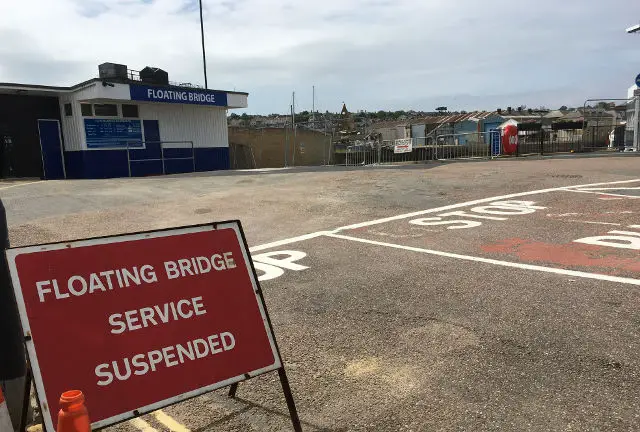
Chain Ferry (closed for maintenance)

We arrived at Cowes without further problems.

At the floating bridge there was a long queue of pedestrians and cyclists and a big red sign in the middle of the road reading "Service Suspended".

For a couple of minutes, I thought we would have to cycle back to Newport and then along the east bank of the Medina all the way to East Cowes (over 1hrs extra cycling, with dodgy spokes!).


Somebody in the queue informed us that there was a replacement boat but obviously it would take longer to cross due to the much lower capacity of the boat.  We managed to squeeze in after about 3 crossings waiting. It was quite choppy and I had difficulty balancing my bike vertically on the back wheel with the front up in the air (without hitting seated passengers).


We arrived at the Ferry port about 50 mins before departure.  Spotted a Chinese takeaway near the terminal and decided it would make a nice snack on the Ferry. We hadn't had much since breakfast.

Here is the menu.  I had a 141 and Joe had a 23. To find what we ate is an exercise for the reader.

There was a beautiful sunset on the way back over the Solent and then Southampton Water.

Arrived in Southampton to discover that Joe had a puncture. It was getting dark and this point and we had no lights. After a brief assessment, I concluded it was only a slow puncture.  So pumped it up and travelled the final 20 minutes back to the car. It was still where we parked it in the quiet resident cul-de-sac near Southampton common (see: part 1).

Looking forward to the 2020 IOW tour now ...


Monday, 23 September 2019

Ride to the Velo Cafe - 22/09/19

Ride to the Velo Café

I read an article in the cycling press about a cafe near me which has an injunction against it.
Coincidentally, my son visited that cafe recently on a bike excursion.

I decided to have a look on Sunday afternoon. The weather was a bit dodgy (it had been raining most of the day but had now stopped). Decided to head-off and risk it.

Headed across the centre of Reading (from the West [Bath Road]) via the kennet and avon canal cycle path. This allows one to skip all the congestion in the centre. The Oracle shopping centre was pretty congested however. Once past the centre just follow the canal all the way to where it ends at the Thames.

Followed the Thames for a little until the Thames Valley business park then turn right under the railway (bike/pedestrian) tunnel. Up Shepherds Hill to the big roundabout. Then along the Old Bath Road which runs parallel with the New Bath Road but without the traffic.

The Old Bath road an

... later …

got puncture just as nearing the Velo cafe.

Kind person lent me a pump, tyre lever and magic patch.
Noticed the puncture was a slow and had not gone down much so dispensed with the patch and just pumped it up again. It seemed to be holding so did a mad dash home (before it went down again).
Managed to get home ok so wondered if it was not the remnant of the IOW slow puncture.  Discovered the next morning that it was not [completely flat]. Phew, providential that I made it home.

Monday, 16 September 2019

IoW Tour 2019 Day 1 - Reading to Southampton, East Cowes to Shanklin (14/09/19)

Isle of Wight Tour 2019


Day 1  - Reading to Southampton, East Cowes to Shanklin
(14/09/19)


Southampton - Free Parking
Set off from Reading at 6am. Arrived in Southampton 7.15am.

Parked in a quiet residential street near Southampton Common (just about where that grey car is in the picture right).
An uneventful 20-minute cycle ride through Southampton - on a quiet Saturday morning - followed. The temperature was about 18 degrees and climbing.

Arrived at Red Funnel ferry about 30 minutes before departure (for the 8am crossing). I had a bit of a panic when we discovered that the ticket office was closed. Had to navigate the Red Funnel wifi connection and book a ticket online before discovering that there was a ticket machine just down the end of the hall (Doh!).

Lovely crossing via Southampton Water and the Solent in bright sunshine. Sat inside and had a snack and then went out on the deck and watched the ferry dock in East Cowes.


Cowes (you cannot milk)

The great thing about cycling onto the ferry is that you get off first. Literally, as the doors were opening the 10 or so cyclists went streaming down the ramp and onto the island, past Waitrose and then onto the main road (A3021) into East Cowes towards Osborne House. It's quite a steep hill and the more accomplished cyclists whizzed past me as I stopped half-way up the hill to get my breath back.

St. Mildred's Church - missed this, bummer!
I had originally planned to weave my way through the residential streets of East Cowes (so missed out of St. Mildred's Church - see pic.) but the traffic was light and taking the main road was quite a bit faster.

Made good progress along the A3021. I got a little confused when we got to a roundabout I had not anticipated from memory (I'd planned the whole thing using Google Streetview; what a wonderful FREE resource). Took the 1st exit on instinct. Checked on my phone based (offline) map about 100 yards later and the instinct had been correct. The next turn was 100 yards further on the left.

Took Alverstone Road then Brocks Copse road towards Wooton. Beautiful, well surfaced quite narrow road (so no cars) and gentle downhill so covered about 1/2 mile without pedaling. The section in the woods was uphill though but quite a gentle uphill. Arrived in Wootton much more quickly than expected.

Joined the main road in Wootton (following the round the island route). The main road was pleasant, traffic was light and all downhill to Wootton Bridge. Stopped at Wootton Bridge to take a picture. Kite Hill was steep but not that long. Took the wrong left turning for Fishbourne and got a bit lost in the various coastal route paths.

Eventually found a way back to the Fishbourne-Portsmouth ferry entrance. Filtered past the backed-up traffic and turned right onto the footpath leading up past Quarr Abbey, This led (via a golf course) to the outskirts of Ryde.

Ryde (where you walk)

The path through the golf-course leads back to the main road but then immediately turns off to the left onto a quiet residential road (Spencer Road) which leads all the way into central Ryde. Then a 2 minute downhill tear to Ryde esplanade. A gentle breeze in bright sunshine. My vitamin D supplies have been restocked.

Took a detour to see David Icke's mansion 😀 (click to see video).

Stopped near the pier to take in the view. The last time I was here the sea was a bit rough and I had gone for a swim and dived off some of the concrete breakwaters into the choppy waves.

Adjusted Joseph's seat to give a more comfortable ride.

Rode along Ryde esplanade past the Hovercraft and the railway tunnel (to St John's Road). There were some American muscle-cars parked along the seafront which we stopped to look at.

Appley Towers
Followed the promenade toward Seaview past Appley Towers. It looks like something out of a fairy tale. The cycle path follows the shore with a short detour inland around Puckpool park. There's a mini-golf course. I remember playing there about 50 years ago (shudder!).

It reminds me of a riddle.

This thing all things devours:
birds, beasts, trees, flowers;
Gnaws iron, bites steel;
grinds hard stones to meal; 
Slays king, ruins town,
And beats high mountain down.


Followed the coast all the way to Seaview where we had to divert to the high-street for a modest distance and then various coastal paths of varying standards of bumpiness towards the Priory bay Hotel.

The path led past Nodes Point holiday village.  Got a bit lost here and had to consult the map to get back on track.

Back on track; got to St Helens and took a brief left-turn to visit (the very nice; popular with the locals) Duver Beach. It was getting close to lunchtime now so needed to decide the best location to get lunch. Decide to visit Brading where we knew there was a very good Fish and Chip shop.

Had to take a bit of a detour via a very stony path across Brading marshes but it was worth it as it was a good short cut. It follows the course of the old railway line from Brading to St Helens Railway Station (which was felled by the Beeching axe) I wondered if either of us would get a puncture here as it was very bumpy but everything was fine.


Got to Brading at 11.45am and headed for the Fish and Chip shop. It did not open until midday so headed for Down Edge (a holiday house where we had stayed a few months earlier).  Nobody was home (but here is a nice video).

The fish and chips were outstanding. We sat in the Bullring and ate them washed down with a bottle of Coke.

Followed the stony path back to St Helens to continue the route.  Then onto the B3395 road towards Bembridge Marina.  There were some pretty house-boats which we stopped to look at.

Got a bit lost in Bembridge and followed a rough path to a secluded beach.  There was no promenade here so went back to the main road and followed it to Bembridge high street. Consulted the map again and were obviously looking a bit lost because a nice lady asked us where we were heading (Culver Down) and gave us directions.

Field - without cows!
Eventually, found the route back to the original plan via Mill Road and Hillway Road. This led to a dead-end road which became progressively more unpassable.  It terminated at a gate with a field full of cows leading uphill in the general direction of the Yarborough Monument on Culver Down.

We had to lift out bikes over the gates and climb over stiles at the entry and exit of the field. The cows obligingly just moved out the way as we traversed the well-traveled path.  A steep path up the hill followed with fantastic views of Whitecliff Bay and Bembridge harbour.

(picture of me and Joseph at Culver point)

At Culver point saw a plane take off from Bembridge Airport. Had to lift the bikes over a gate to get to the road that led along Culver cliff toward Yaverland (bloody annoying, I guess this is to kids on motor scooters whizzing around culver point).

It was difficult to cycle along the top of the cliff. There were some very nasty bumps. I think I developed a (slow) front puncture along here which became more obvious nearer Shanklin.

The views from the top of the cliff were outstanding. The sun was shining and there were very few clouds. I started singing "Don't fall off the cliff".

(to the tune of Lloyd George knew my father)
Don't fall off the cli-i- i-i-if
Of the cliff don't fall
Don't fall off the clii-if
Of the cliff don't fall

.... (well you get the idea),

Yaverland to Sandown

Heath Cottage (sans garden)
The Culver Downs ends in a car park in Yaverland. We then followed the promenade and then Sandown high street to the Pier.

We stopped to take a look at Heath Cottage in Beachfield Road - a holiday house I stayed in as a child.  Somebody has built a house in the back garden!


Headed down the hill where the Blue Lagoon penny arcade once stood (long gone now and Wight City Arcade is no more).  A bit like the decomposing composers.


Followed the path along the bottom of the cliffs from Sandown via Lake to Shanklin. The surface was good at first but got increasing gravelly as we neared Shanklin.  I discovered that I had a slow puncture at this point. I wasn't sure whether it was caused by the gravelly path of the earlier very bumpy surface on Culver cliffs.


We walked up Hope Hill/Road, Atherly Road to our Hotel, Langham Court (a very nice/economical hotel with a Fawlty Towers vibe).

The initial room we were given had someone in it (fortunately they were not there at the time). The room (with nobody in it) was much better. Had a nice cup of tea and a sit-down and a shower and felt much better.

Regulating the hot and cold water via the taps proved a considerable challenge.


We went for a walk around Shanklin.  Saw the remains of the pier which was destroyed by the Great Storm of 1987.

All that remains is a plaque on the stump of the pier.

"Nothing beside remains. Round the decay
Of that colossal Wreck, boundless and bare
The lone and level sands stretch far away.”
https://www.poetryfoundation.org/poems/46565/ozymandias

Continued ... in part 2.